|
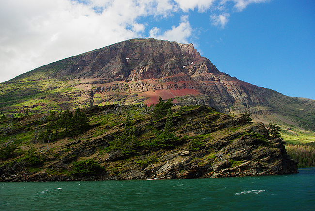
The north shoreline of St Mary Lake during a boat excursion aboard the "Little Chief," operated by the Glacier Park Boat Company... |
|
|
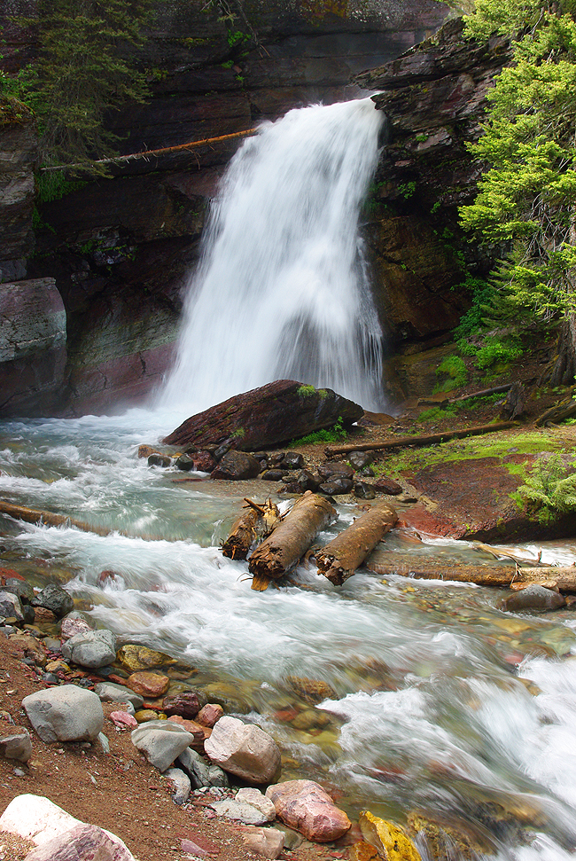
Baring Falls, reached by boat from Rising Sun via St. Mary Lake...The cascade is just a hundred feet or so from the dock... |
|
|
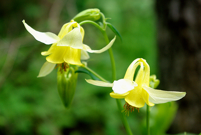
Along the path to Baring Falls in Glacier...Yellow Columbine - a perennial herb that grows up to 28 inches in height. They are especially attractive to hummingbirds and butterflies... |
|
|
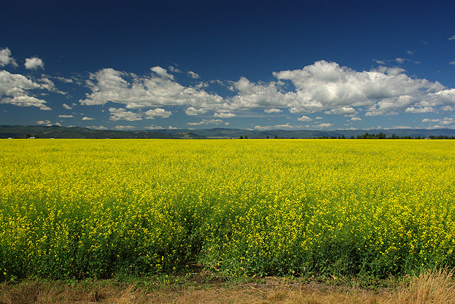
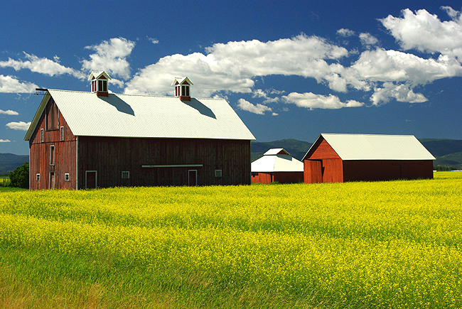
Beautiful farmland greets the traveler along Montana Scenic Route 83 through the Flathead National Forest, between Swan Lake and Condon, MT. The road follows the Swan River and the Mission Mountains to the West... |
|
|
|
|
|
Gorgeous farm country along Highway 83! |
|
|
Looking east along Route 83, heading south toward Seeley Lake, MT |
|
|
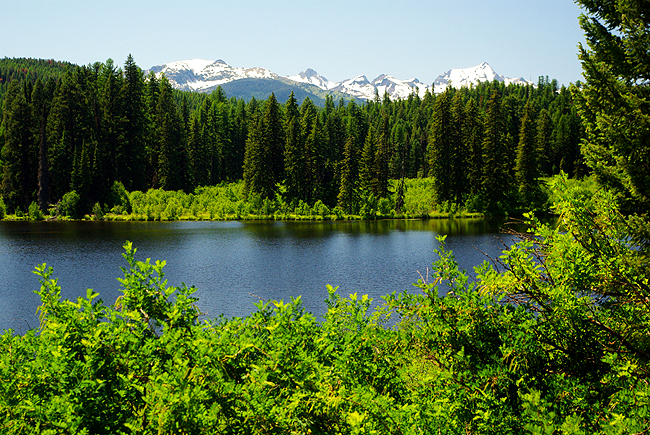
A view of Summit Lake, fed by the Swan River, with the snow-covered Mission Mountains Wilderness to the west... |
|
|
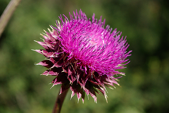
Musk Thistle - technically a weed - is lovely nonetheless. The flower above is growing on the National Bison Range, northwest of Missoula, Montana... |
|
|
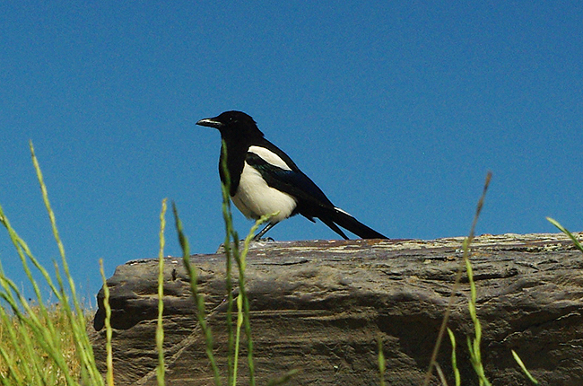
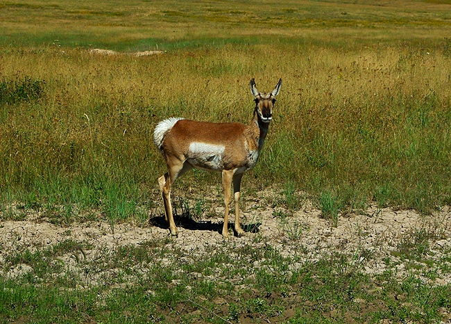
The National Bison Range, by the way, is NOT to be missed! Entered at the "town" of Moiese on Montana Route 212, it is home not only to the last remaining wild Bison herd in North America, but to a myriad of wildlife including the Magpie above and antelope below, to name a few... |
|
|
|
|
|
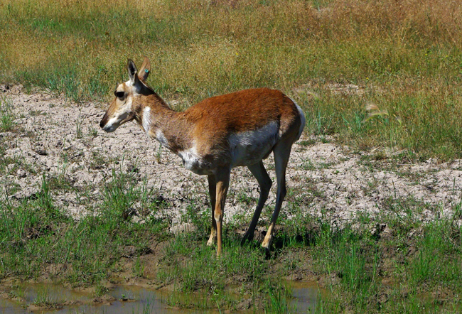
Two images above: This little antelope was wary, but bold (and thirsty) enough to approach both Dennis and a muddy waterhole at road's edge, with the rest of the herd watching very closely in the distance...One by one, each took its turn at the water. |
|
|
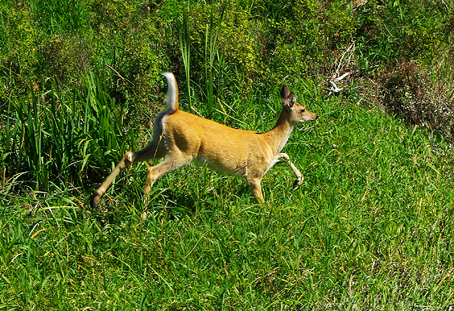
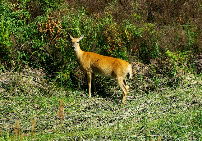
Whitetail Deer also share the range - this one having just bounded out of the brush as another watched us photograph her (below) along Red Sleep Mountain Drive - a 19-mile, one-way gravel road through the preserve. The drive is worth every minute! |
|
|
|
|
|
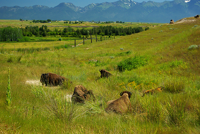
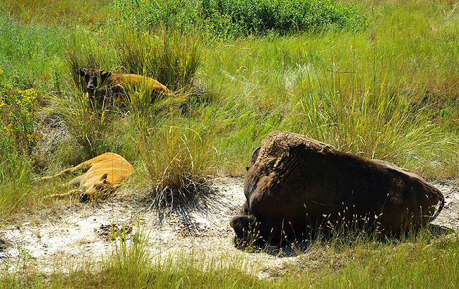
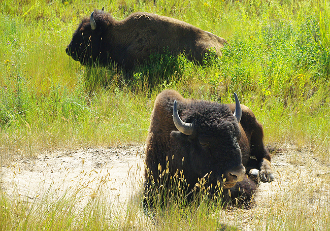
Above and the two images below: Bison (and babies) rest in the dry summer sun at the National Bison Range in Northwest Montana... |
|
|
A large portion of the 18, 500 acre Range consists of native Palouse prairie; forests, wetlands, and streams are also found here, providing a wide range of habitats for wildlife. Elk, deer, pronghorn antelope, black bear, coyote and ground squirrels are just some of the mammals that share the area with 350 to 500 bison. Over 200 species of birds also call this home including eagles, hawks, meadowlarks, bluebirds, ducks, magpies and geese. |
|
|
Grunt...Uh...That's close enough, thanks! |
|
|
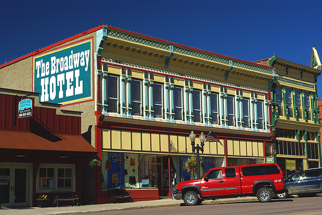
About midway along the Pintler Scenic Route - Montana Route 1 out of Wise River, following Flint Creek - is the carefully restored and maintained town of Philipsburg... |
|
|
|
|
|
Two images above: Along West Broadway Street in Philipsburg |
|
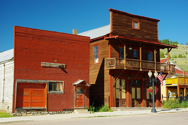
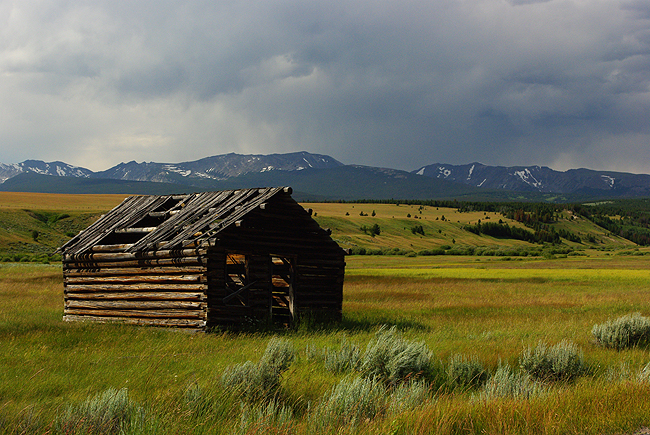
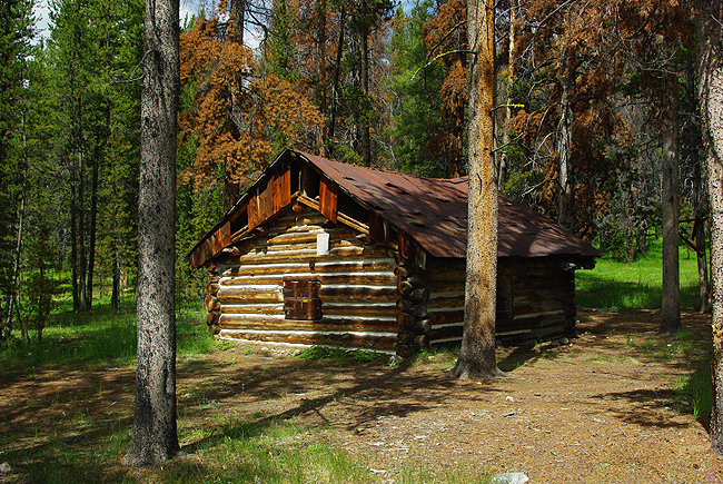 An historic log cabin deep in the forest, along the road to the ghost town of Coolidge, reached by dirt road off the Pioneer Mountains Scenic Byway in Montana... |
|
|
|
|
|
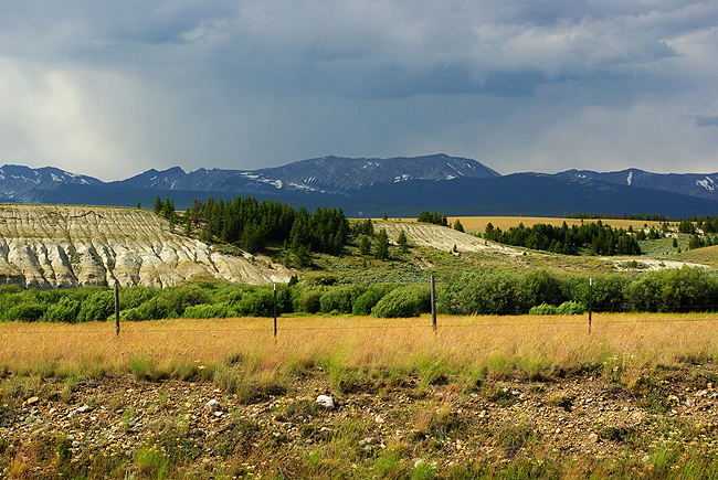
Above two images: More glorious scenery - A thunderstorm approaches over the Pioneer Mountains to the west, in northwestern Montana, along the Pioneer Mountains Scenic Byway
|
|
|
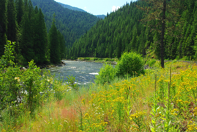
The Lochsa River, looking west along Idaho Route 12 - the Lewis & Clark Trail. The waterway is part of the Wild & Scenic River Corridor and thus remains very much as Lewis and Clark would have seen it as their expedition moved west in 1805! Many historical points along the road are marked with plaques denoting various camps, crossings, etc. by L&C, as they moved both westward in 1805 and then back east in 1806. |
|
|
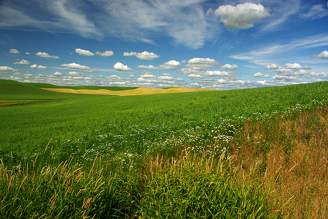
A final scene - beautiful rolling farmland along Route 195 north in Washington State, as we travel toward Spokane for our return home...We hope you will consider visiting this part of the US soon! All images c. 2011, Dennis A. Hubbs, D&D Travel Services, LLC |

|
Thanks so much for looking...Let us know if you enjoyed your visit? [HOME] email: dennis@ddtvl.com - Donna and Dennis |